Bukit Boyan - Rating IBP 100
MUST READ -
(NEWBIES) Have you submitted the KLH one-time Membership Form...? If not, do so by clicking here.
(REGULARS) Is your info outdated...? If so, submit the Update Form by clicking here.
DO NOT click 'RSVP' or do not join this event without reading, understanding and accepting the content of the Knowledge Base.
If you are keen to participate, kindly submit the Participation Form.
IMPORTANT: Limited slots available. We accept bookings on a first pay, first serve basis and only for a block of 7 pax due to MGP guides ratio of 1:7.
No payment before Monday 17/02/2025 - 11:59 pm means no participation.
We have been exploring the area around Sungai Sendat Waterfall in the past but have never hiked to the summit of Bukit Boyan.
The car park near the waterfall will be the trailhead for this hike.
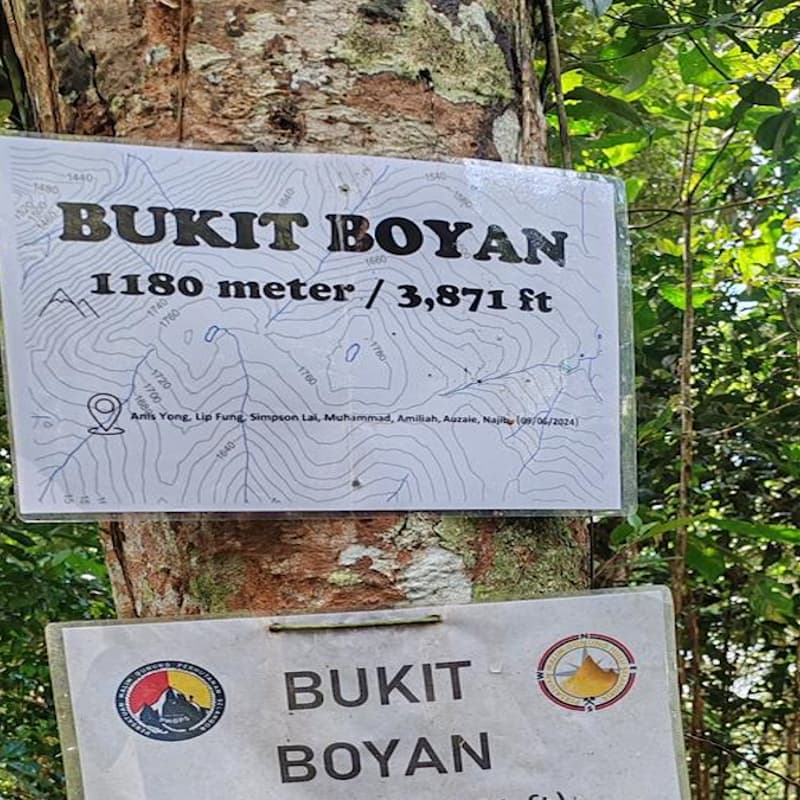
Located in the Batang Kali Permanent Forest Reserve, northwest of Gunung Bunga Buah, the summit of Bukit Boyan, with an elevation of 1,180m asl, can only be reached after a hike of almost 8 kilometres.
We do hike the same way in and out, so the total distance will be around 16 kilometres. The elevation gain to the summit will be more than 1,100 metres.
At places the trail is still pretty rough and has a few stream crossings along the way.
The IBP rating says it all. If you are not fit or have not hiked for some time, you have to give this event a miss. Don't put yourself at risk...
---> We will perform a check of the mandatory items before the event starts. For your own safety, if you do not have the mandatory items in your possession, we will not allow you to hike. <---
IMPORTANT: Make sure you have a gps navigation app (like ~in alphabetical order~ AllTrails (paid version), Gaia, Hiiker, Komoot, Maps.me, OSMAnd, Wikiloc,...) installed on your phone and make sure that it is working properly. If you don't have an app installed yet, we suggest to use Hiiker to start with. Once you have downloaded the offline map of Malaysia, you can easily import and navigate any gpx file. More info can be found in the Knowledge Base sub Event Information (general) - How to prepare myself for navigation...?
Do not come to the venue if you have not pre-installed a gps navigation app at home, or have not downloaded the map of Malaysia at home, or have not opened the test gpx file at home. Every week, we notice that too many hikers arrive just before the event starts and are absolutely not prepared which is jeopardising the scheduled timing of the event. Especially iPone users are urged to make sure that they can open the test gpx file at home and are able to navigate.
Although there will be guides, this still remains a self-guided hike. You will receive a gpx file in advance and you will have to navigate yourself. There will be no paper markers.
For more details and procedure, follow this link.
IMPORTANT: keep in mind that there is always a chance that we are not allowed to hike due to dangerous weather or other conditions (eg heavy rain, flood, landslide, health measures...) - we cannot be held responsible for such cancellation.